I need a hex map
My party of adventurers are sailing to the Lemurian Remanant as part of a quest imposed upon some of them so they could heal from the damage of an automaton. Think the some what misinterpreted way a clay golem in 1e AD&D does damage. In this case, in Hyperborea that interpretation is clear.
In any case, in their last session they fended off many attacks. From giant octopuses, giant squids, and a bunch of great white sharks. As it so happens, a shark was able to take a damaging bite out of their ship.
They had already planned to stop at an island on the charts to prepare for the crossing of a nasty part of the open sea, the River Okeanos. With the damaged ship, the stop has become imperative.
I was mostly going to handwave the stop for the most part. Now, I kinda want to plop down something and see if it I can distract them.
First, I needed to make a map of the island and I think it needed to be hexes since it's "wilderness".
That means two things:
So, once you have Inkscape installed as well as the extension you are head to make some hexmaps to your heart's content.
First I created a page full of 2.5" (flat side to flat side) hexes on US letter sized paper. In the Style table I have Rotate option checked. This have the hexes "pointy end" towards the top of the page.
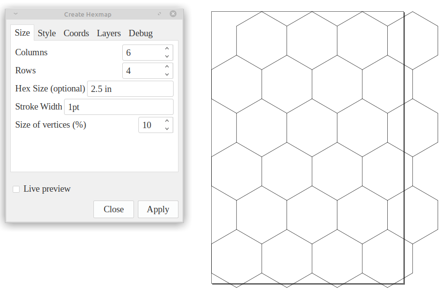
These hexes represent 25 miles per hex. For a bit finer detail I then wanted to add in some 5 mile hexes. I partly chose the 2.5" hex partly because it's easily divisible by 5. I also created a new layer so that each new hex size are independent from each other and I change the properties of them.
You will need to try and undo the number of columns and rows so that the hexes cover the page just enough.
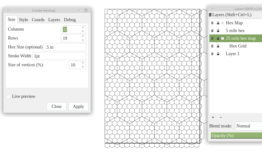
I had considered a third layer of .1 in hexes but that creates a lot of svg objects and it can bog down your computer a bit when you need to change properties or even group them together.
Once I had this base map I added the rough shape of the island from the Hyperborea map along with what I am interpreting to be breaks around it. Reefs or other navigation hazards for large ships.
I wasn't not satisfied with how the map was turning it.
I finally decided what I needed for the map the players will see is one large hex with smaller hexes inside that. The big hex being 25 miles and the smaller hexes being 5 miles.
So I created a monstrous 8" hex, 1.6" hexes inside that, and .12" hexes inside those. Yeah, I did just say that those are a pain and resource drain. However, I only made enough to just fit the big hex.
I then meticulously deleted everything outside the monster hex (uploaded as slightly different version since someone noted some weirdness with it and we'll see if this helps --edit 2020-09-22).
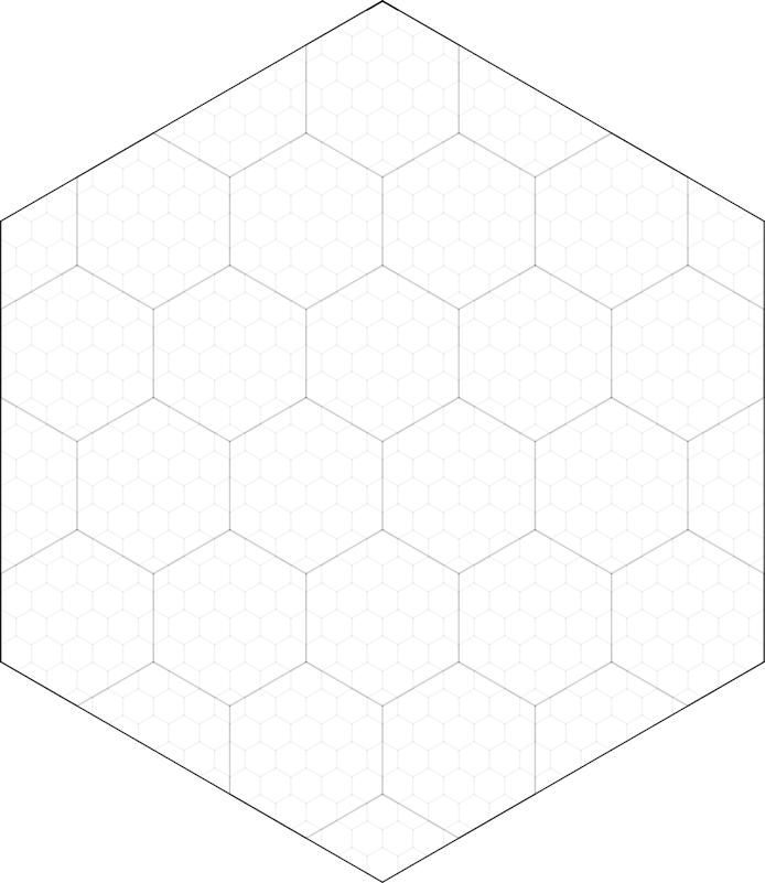
I changed the shading/"grayness" of the lines for each hex type. You do this under the "Fill and Stroke" submenu under the "Object" menu. The big, 25 mile hex is pure black: 255. The 5 mile hexes are a dark grey: 100. Finally the 1 mile hexes are a light grey: 25.
So, being a lazy DM I started looking through my various old school things I've bought over the years.
I reached for the Echoes from Fomalhaut(EFF) published by E.M.D.T. First Hungarian D20 Society. Gabor Lux is the force of nature behind this excellent zine. You can get pdf's from Drivethrurpg. However, do yourself a favor and get the paper version mailed to you from Hungary. When maps are provided with the zine the paper is top quality. Seriously, I like the paper used for these maps so much. You should also get the pdf version with your purchase (I will update this post if that is not the case).
I had thought about The Beekeeper from EFF #01 but kept scanning through the rest.
Terror from Tridentfish Island in EFF #03 really filled my need. It even has the same vibe and even some world hooks that work great in Hyperborea. I just need to smudge it a little and munge things to work with where it needed to go.
A little work later and I have something I can use. This is only the geography of the island. I can't show off the fun bits. You gotta get Gabor's excellent work to find out what my party might find on the island if they go exploring it instead of attending to the needed repairs.

Thanks to Inkscape to making a tool that I'm capable of making a basic tool of the DM trade.
Thanks to Pelle Nilsson for making an extension to Inkscape so I can make hexmaps to my specifications.
Thanks to Gabor Lux for continually make some of the best old school content out there. When he posts he has something new to buy I don't think twice about rushing to purchase it.


